MAPS

[John Cooke of Hendon, English cartographer.] Engraved map of Cairo, Egypt, titled 'Plan du Kaire et des Environs', including plan of the 'Chateau du Kaire' and key to 'Ghize'.

Author: 
John Cooke of Hendon (c.1765-1845), English cartographer, successively of Mill Hill, Hendon, Middlesex, and (from 1799) Howland Street, London [Cairo ('Kaire'), Egypt; Pierre Didot, Paris publisher]
Publication details: 
[Paris: Pierre Didot, 1802.] Engraved at bottom right: 'John Cooke, sc. 50 Howland St' (London).
£220.00

Thirty-six works by Cooke are listed between 1790 and 1843. The present item, along with its companion piece ‘Carte de la basse Egypte: dressée d'après les observations astronomiques de C. Nouet, et les reconnaissances des ingénieurs et officiers employés à l'Armée d'Orient’, appeared in ‘Planches du Voyage dans la Basse et la haute Egypte, par Vivant Denon’, published in Paris by P. Didot in 1802. Both have the engraved signature ‘John Cooke, sc, 50 Howland St.’ The dimensions of the map are approximately 31.5 x 23.5 cm.

[Ecclesiastical atlas,1843, with maps by von Stülpnagel and letterpress by Wiltsch.] ‘Atlas sacer sive ecclesiasticus inde ab antiquissimis religionis Christianae propagatae temporibus usqe ad primordia saeculi decimi sexti'.

Author: 
Joanne Elieser Theodoro Wiltsch, Cand. Rever. Minist. [Johann Elieser Theodor Wiltsch] (1803-1873); Johann Friedrich von Stülpnagel (1786-1865), Prussian cartographer [F. D. Maurice; Queen’s College]
Publication details: 
Gothae, Sumptibus Justi Perths. MDCCCXLIII. [1843.]
£1,800.00

The full title reads: ‘Atlas sacer sive ecclesiasticus / inde / ab antiquissimis religionis Christianae propagatae temporibus usqe [sic] ad primordia saeculi decimi sexti, / respectu habito / Judaeorum per totum orbem dissipatorum nec non regionum a gentilibus ac Mohammedannis incultarum / singulis tabulis, / descriptus / a / Joanne Elieser Theodoro Wiltsch / Cand. Rever. Minist.’ A folio volume, with the five maps, each of which is double-page folio, all having borders and boundaries picked out in colours.

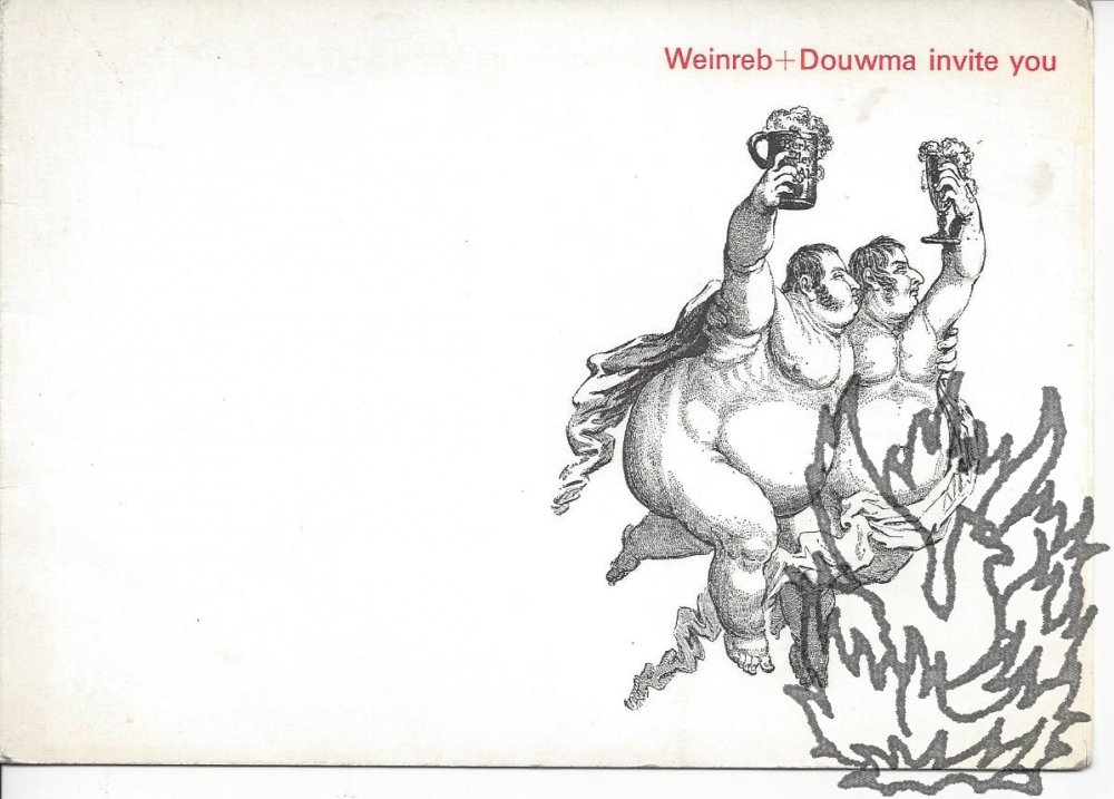
[Ben Weinreb, London bookseller and editor of ‘The London Encyclopedia’.] Autograph Note Signed [to fellow bookseller Andrew Block] on attractive printed invitation card for the opening of the new ‘Weinreb + Douwma’ print and map shop.

Author: 
Ben Weinreb (1912-1999), London bookseller and authority on architecture, first editor of ‘The London Encyclopedia’ [Robert Douwma, printseller; Andrew Block, bookseller]
Weinreb
Publication details: 
Invitation to shop opening, 26 January 1970; 93 Great Russell Street, London WC1.
£45.00
Weinreb

See Nicolas Barker’s appreciative obituary in the Independent, 7 April 1999, which notes that after selling his entire stock to the University of Texas in 1968, ‘He moved his business to the other side of Great Russell Street, and briefly opened another shop, selling prints in partnership with Rob Douwma.’ (The British Museum website states that ‘Weinreb & Douwma was on the corner of Great Russell Street and Bloomsbury Way during the 1970s and 1980s.’) The obituary of the recipient Andrew Block (1892-1987) in ‘The Private Library’ was subtitled ‘the doyen of booksellers’; his business w

[ Major-General Sir Henry James of the Royal Engineers, Director General of the Ordnance Survey. ] Autograph Letter Signed ('Henry James.') to Sir John Fox Burgoyne, regarding Sir Emerson Tennent and 'abstracts from Meteorological observations'.

Author: 
Major-General Sir Henry James (1803-1877) of the Royal Engineers, British army officer, Director General of the Ordnance Survey, 1854-1875 [ Sir Emerson Tennent (1804-1869); Sir John Fox Burgoyne]
Publication details: 
On letterhead of the Ordnance Map Office, Southampton. 20 November 1856.
£80.00

3pp., 12mo. Bifolium. In good condition, lightly aged. Addressed to 'Sir John F. Burgoyne. | Bart:'. He is sending 'a copy of the Abstracts from Meteorological observations taken at our Foreign stations, in which Sir Emerson Tennent will find the abstract from the observations taken at Columbo in the year 1853-4'. He is also sending abstracts from subsequent years which 'have not yet been printed'.

[ Port of Manchester. ] Pamphlet with eighteen-ship 'itinerary' of vessels present at a 'visit', accompanied by five maps [ 'Principal oil docks and installations with their road connections', 'Hinterland', 'Dockside Area' ], three of them fold-outs.

Author: 
[ Port of Manchester ] [ George Falkner & Sons Limited; Dunlop, Heywood & Co. ]
Publication details: 
[ Port of Manchester. ] George Falkner & Sons Limited, Manchester. With section dated 16 July 1959.
£180.00

Five maps, four of them fold-outs, together with duplicated text on two leaves, stapled into 8vo pamphlet of buff printed wraps with 'PORT OF MANCHESTER' and logo on the front, and printers' slug on back. In fair condition, lightly aged and worn. The five maps include three fold-outs: the first, coloured in blue and light and dark green, titled 'Principal oil docks and installations with their road connections' ('For particulars of sites on the Company's Estate application should be made to the Company's Land Agents | Dunlop, Heywood & Co.

Printed 'Particulars and Conditions of Sale of the Freehold Landed Estate known as "Landwade Hall," [....]'

Author: 
[ Alexander Cotton of Landwade Hall, Camrbidgeshire; Sir Richard Harington of Ridlington ] Cheffins, auctioneer, Saffron Walden, Essex
Publication details: 
Mr. Cheffins, On Friday, June 8th, 1900, At the Auction Mart, Tokenhouse Yard, London, E.C. [ W. Thompson, Printer, Market Place, Saffron Walden. ]
£120.00

Victoria County History, Cambridgeshire, Volume 10, describes how, on the death in 1812 of Admiral Sir Charles Cotton, Landwade Manor 'passed to his son Sir St. Vincent Cotton who came of age in 1822. In 1850 he sold Landwade to Alexander Cotton, probably his younger brother (b. 1804).

British Army Boer War map of 'Melmonth [ i.e. Melmoth ]': 'Sheet No. 37' in 'Transvaal (Major Jackson's Series)'.

Author: 
Major H. M. Jackson, Royal Engineers [ Field Intelligence Department, Pretoria; Boer War map: Melmoth, Transvaal ]
Publication details: 
[ British Army ] Field Intelligence Department, Pretoria, 1901. 'Photo-lithographed - Pretoria - June 1901 | Mapping Section - Field Intelligence Dept - Army Head Qrs.'
£80.00

Photolithographically printed in black on one side of a 51 x 63 cm. piece of cloth, folding into a 16.5 x 11 cm. packet, in green printed cloth covers backed with card. In good condition, lightly-aged, with minor signs of age and wear. Cover reads: 'Transvaal. | (Major Jackson's Series). | Sheet No. 37. | Melmonth. | Field Intelligence Department. | Pretoria, 1901.' Signed in pencil on front cover 'G S Scovell | Cam Hrs.' In top left-hand corner of map: 'No. 37'. In bottom left-hand corner: 'Compiled in Surveyor General's Office - Pretoria underdirection [sic] of MAJOR H. M. JACKSON R.E. Mch.

[Printed map by J. Banfield, "Arrival List" Office, Ilfracombe.] A Plan of the Town of Ilfracombe, together with a Map of the North Coast of Devon.

Author: 
John Banfield, printer and publisher ('Arrival List' Office), Ilfracombe, Devon
Publication details: 
J. Banfield, "Arrival List" Office, Ilfracombe. No date.
£100.00

25.5 x 31 cm, folded three times to make 12..5 x 8.5 cm packet, with title and publisher's details on the outside. In fair condition, on aged and worn paper. Tipped-in onto a leaf removed from an album. Light pencil notes on back of map. At head: 'A Map of the North Coast of Devon' (7.5 x 25 cm). At foot: 'A Plan of the Town of Ilfracombe, published by J. Banfield, Library, Ilfracombe' (12 x 25 cm). In right hand margin: 'Reference to the Plan', with 42 entries from 'Tunnels' to 'Montpelier Road'.

Lithographic coloured London Fire Force plan, indicating the wartime Emergency Water Supply to the Trafalgar Square and Whitehall area of London, headed 'E. W. S. No. 284 | Plan referred to on Sheet No. 10 Water Unit Maps | re Government Buildings'.

Author: 
[London Fire Force; Metropolitan Water Board; Fire Fighting in the Second World War; maps and plans]
Publication details: 
Without date or place. (London Fire Force, circa 1943.)
£180.00

On one side of piece of 41 x 20.5 cm paper, with lines and indications in light and dark blue, red and green. In fair condition, on aged paper, with creasing and one closed tear towards the head. The map has Trafalgar Square at its head (with the note that the two 'Basins' carry '40,000 Galls. each') and Parliament Square at its foot. Whitehall and Parliament Street connect the two on the right of the map, and to the left of the map is the lake in St James's Park: '200000 Galls Underground Tank | Pumping Station 1400 Galls | Pump | 15 foot Gravity Main from Serpentine'.

[Printed booklet.] Catalogue of the Books in the Library of the Bristol Naturalists' Society. [With replacement coloured chart 'to accompany Dr. Burder's Paper on Storms'.]

Author: 
[Bristol Naturalists' Society, Clifton; William Corbett Burder]
Publication details: 
May, 1881. Clifton: Printed by E. Austin & Son, Chronicle Office. 1881.
£180.00

[1] + 24pp., 8vo. Stitched. In fair condition, on aged and lightly-spotted paper, with slight wear to edges of covers. A notice at the front reads: 'The Name following the title of a Book is that of the Donor. Where no Name is given, the Book has been obtained by purchase or by exchange.' The first two entries read: 'Ainsworth, William. Account of the Caves of Ballybunian. 1834. Henry Harris. | Airy's Lectures on Astronomy. 1849. F. F. Tuckett.' Loosely inserted are the replacement chart and a slip of paper carrying the note: 'BRISTOL NATURALISTS' SOCIETY.

[Large printed colour poster, issued by the Army Bureau of Current Affairs.] The Infinite Variety of the U.S.S.R. [ABCA Map Review No. 2.]

Author: 
ABCA Map Review No. 2 [Army Bureau of Current Affairs (A.B.C.A.), W. E. Williams, Director; Second World War propaganda]
Publication details: 
'Printed for H.M. Stationery Office by Fosh and Cross, Ltd.' 'The period from November 23 to December 6, 1942.'
£180.00

Printed on both sides of a piece of paper roughly 38 x 100 cm. In fair condition, on lightly-aged and creased paper. Folded four times. The outer side, printed in black and white, carries the article on the Soviet Union, with thirteen photographs (including ones of Stalin and four other party leaders) and a large map. The other side carries the ABCA Map Review No. 2, covering the period from 23 November to 6 December 1942, with large coloured map, and dealing with seven themes from 'Russia' to 'The Prospects for Italy' and 'The War against Want'. An attractive piece of modern design.

[Large printed colour poster, issued by the Army Bureau of Current Affairs.] Britain's Radio Covers The World. [ABCA Map Review No. 6.]

Author: 
ABCA Map Review No. 6 [Army Bureau of Current Affairs (A.B.C.A.), W. E. Williams, Director; Second World War propaganda; British Broadcasting Corporation; BBC]
Publication details: 
'Printed for H.M. Stationery Office by Fosh & Cross, Ltd.' 'The period from January 18th to January 31st, 1943.'
£180.00

Printed on both sides of a piece of paper roughly 38 x 100 cm. In good condition, on lightly-aged and creased paper. Folded four times. The outer side, printed in black and white, carries the article on 'the vast broadcasting network which spreads across the world from Britain', with large stylised map, with BBC microphone, indicating 'The BBC broadcasts day and night in 47 languages, to 200,000,000 listeners every week.'.

Contemporary coloured 'Sketch of the Situation of the TOWN of ST. JEAN D'ACRE, with the position of the FRENCH besieging ARMY under the command of General BONAPARTE and the BRITISH SQUADRON co-operating with GEZZAR AHMET PASHA in its Defence [...]'.

Author: 
[The Siege of Acre [Siege of St Jean D'Acre], 1799; Napoleon Bonaparte; Sir Sidney Smith (1764-1840)]
Publication details: 
On paper watermarked 'J WHATMAN | 1816'.
£450.00

A fine plan, so neatly and delicately drawn that it could easily pass for an engraving. The title concludes: '[...] its Defence under the Command of SIR SIDNEY SMITH. Kt. &ca. &ca. &ca. - on the 2nd: day of May 1799.' In landscape on one side of a piece of laid paper, 29 x 42cm, with the plan itself within a 19.5 x 32.5cm border. The drawing and the precise and detailed lettering are in ink, the whole coloured in grey, brown, pink and blue watercolour. On aged and lightly-creased paper, with a couple of small unobtrusive holes. On a scale of one and a half inches to half a mile.

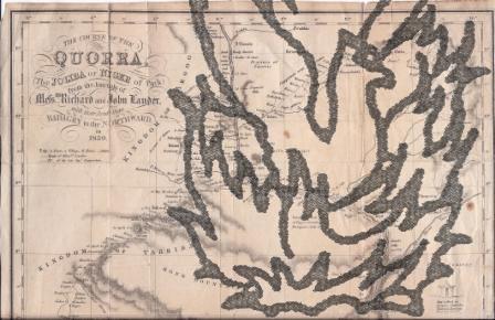
Map by A. B. Becher showing 'The Course of the Quorra, (the Joliba or Niger of Park) from the Journals of Messrs. Richard and John Lander. With their Route from Badagry to the Northward, in 1830.'

Author: 
Alexander Bridport Becher, 1796-1876 [Hugh Clapperton (1788-1827); Richard Lemon Lander (1804-1834); John Lander (1807-1839); Niger [Quorra] River, Nigeria; Africa]
Map by A. B. Becher showing 'The Course of the Quorra
Publication details: 
'A. B. Becher, del. J. & C. Walker, Sculpt.' [Produced to accompany the Journal of the Royal Geographical Society of London, vol. 1, 1831.]
£65.00
Map by A. B. Becher showing 'The Course of the Quorra

Approximately 27.5 x 31 cm. Printed in black and white, with relief shown by hill shading. A detailed map, showing the routes of the 1830 expeditions in Nigeria of the Landers' and of Captain Clapperton. Lightly aged, with closed tears unobtrusively repaired with archival paper. Small vignettes of 'Eboe House' and 'Hut called in Borgoo, Catambo.'

Autograph Letter Signed from Abbott Lawrence, United States Minister to the Court of St James, to James Wyld, Member of Parliament for Bodmin, concerning his gift to the American people of his 'New Map of Central America'.

Author: 
Abbott Lawrence (1792-1855), United States Envoy Extraordinary and Minister Plenipotentiary to the Court of St James, 1849-1852, founder of Lawrence, Massachusetts [James Wyld (1812-1887), mapmaker]
Abbott Lawrence (1792-1855), United States Envoy Extraordinary...
Publication details: 
28 February 1850; 138 Piccadilly, London.
£225.00
Abbott Lawrence (1792-1855), United States Envoy Extraordinary...

4to, 1 p. Text clear and complete. In original envelope, addressed by Lawrence and with his red wax seal and frank ('Abbott Lawrence'), 'To | James Wyld Esqre M.P. | &c &c &c | Charing Cross East'. On aged and stained paper. He thanks him for his 'New Map of Central America', which he will 'transmit to Washington, where I believe it will be thought, that you have made ample provision for the "Mosquito Indians"'. The following year Wyld would erect his 'Great Globe' in Leicester Square, where it would remain until 1862.

Autograph Letter Signed, in the third person, from Lord Churchill to the cartographer William Faden

Author: 
Francis Almeric Spencer (1779-1845), 1st Baron Churchill of Whichwood [Lord Churchill] [William Faden (1750-1836), cartographer and map seller, Charing Cross, London]
Autograph Letter Signed, in the third person, from Lord Churchill
Publication details: 
31 December 1826; Wychwood Forest, Witney, Oxfordshire.
£65.00
Autograph Letter Signed, in the third person, from Lord Churchill

12mo, 2 pp. Nine lines. Text clear and complete. Addressed by Churchill on reverse of the second leaf, with red wax seal, and his frank: 'Witney Dec. thirty one 1826. | Mr. Faden | Map Seller | Charing Cross | London. | [signed] Churchill'. On aged and lightly-creased paper, with a spike hole. Asking Faden to 'send him a small Case map of Gloucestershire, as soon as possible', directed to him by 'Pratt's Gloucester Coach, to be left at Witney'.

Manuscript Map, in colours, by Corporal A. Hunter, of the 'Bilstien [sic, for 'Bilstein'] Defences. scale 1/6250'.

Author: 
Bilstein (Germany) [Junkermuehle, Nassenstein]
Publication details: 
01/02/19
£85.00

Dimensions of paper roughly. Creased, with fraying to extremities, closed tears, and some staining and fading due to damp. A careful production, detailing the fortification to the towns of Bilstein (north-east of Cologne), Junkermuehle and Nassenstein, in black, yellow, red and green, with attractive lettering. 'References' are to 'barbed wire entanglements', 'main roads', 'Woods', 'stream', 'bye Roads' and 'Bridges'. Pencil additions include position of 'SNIPERS'. Ascribed at foot to 'Cpl. A. Hunter' and dated 'February 1919'.

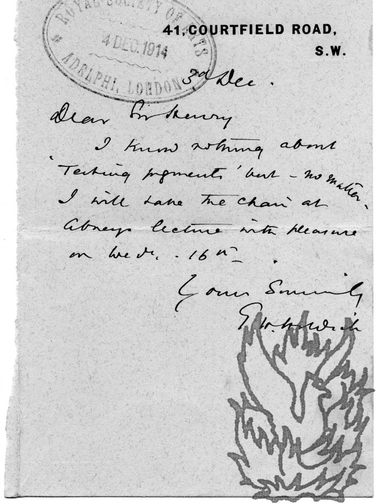
Forty-eight Autograph Letters Signed, and one Autograph Card Signed (all 'T. H. Holdich') to Sir Henry Trueman Wood, Secretary, Royal Society of Arts. With two letters written on his behalf and two enclosures.

Author: 
Sir Thomas Hungerford Holdich (1843-1929), English geographer, President of the Royal Geographical Society
Publication details: 
Between 1914 and 1919. All from 41 Courtfield Road, London SW7.
£250.00

The fifty-two items (in various formats) are in very good condition. Texts clear and complete. On lightly-aged paper. A cordial correspondence regarding the business of the Society, Holdich's close association with which is not noted in his entry in the Oxford DNB. On 21 February 1917 Holdich writes to 'accept the honour of appointment to the office of Vice President of the Society of Arts'.

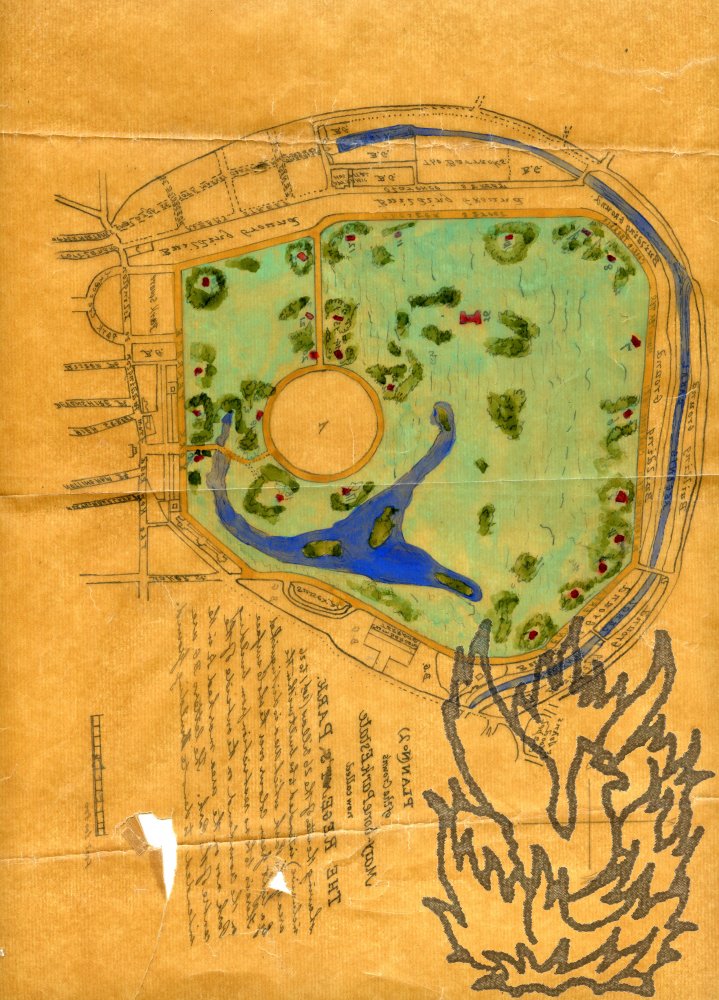
Legal documents relating to a Chancery suit, between Richard Elisha Farrant and the Trustees of the Archer Burton Estate, concerning the property No. 2 Park Square, Regent's Park. Including manuscript map.

Author: 
[Regent's Park, London] [Richard Elisha Farrant; Henrietta Lucretia Archer Burton, Widow, Edward Arthur Maund, and Vivian Ellis Archer Burton, Trustees of the Archer Burton Estate]
Publication details: 
1895 and 1896; London.
£150.00

Item One: Manuscript of requisitions by Farrant the purchaser's solicitors Ashurst, Morris, Crisp & Co of 17 Throgmorton Avenue, London E.C. Dated 31 July 1895. Titled 'Requisition Title [and Replies] | Trustees of Archer Burton Estate to R. E. Farrant | 3 [corrected to '2'] Park Square West'. Three pages and covering page, on one side each of four leaves each 41.5 x 34 cm. Text clear and complete. Fair, on lightly-aged and grubby paper.

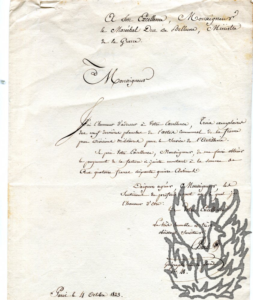
Autograph Letter Signed ('Charle | Geographe rue de Sevres | No. 48.'), in French, to the French Minister of War, 'Monseigneur le Maréchal Duc de Bellune'.

Author: 
J. B. L. Charle, French cartographer [Claude Victor-Perrin (1764-1841), Duc de Belluno (Bellune)]
Publication details: 
4 October 1823; Paris.
£85.00

One page, on the recto of the second leaf of a bifolium, leaf dimensions 31 x 20 cm. In fair condition on lightly-aged paper with slight wear to extremities. According to his entry in the catalogue of the Bibliothèque Nationale, Charles was a 'Géographe attaché au Dépôt général de la guerre en 1933 [sic], ancien membre de la Société de Géographie. - Dessinateur, il eut une production cartographique très abondante à partir de 1823'. Neatly laid out.

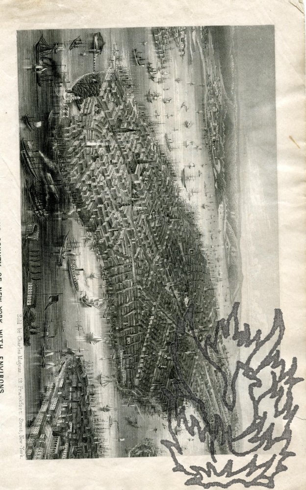
Steel engraving captioned 'Birds Eye View of the City and County of New-York with Environs.'

Author: 
Charles Magnus (1826-1900), German-born American engraver and printseller [New York; steel engraving; maps; travel; topography]
Publication details: 
[circa 1855] 'Sold by Charles Magnus, 12 Frankfort Street, New York.'
£80.00

Dimensions of print 11.5 x 19.5 cm. At the head of the recto of the first leaf of a bifolium (leaf dimensions 28 x 22.5 cm). The print itself is clear and undamaged, on aged paper. With traces of cuttings mounted onto the internal pages, and closed tear to the blank second leaf. An impressively detailed engraving, showing the bustling port and layout of the city, with church spires and prominent buildings. A copy of the item survives used as a letter home from a German girl in 1855. The copy in the New York Public Library is ascribed to 'C. Magnus, Lith. 22 N. William St.'

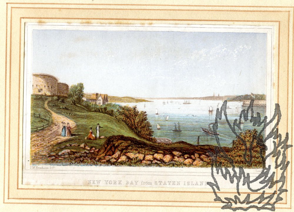
Original coloured Kronheim 'Baxter' engraving, captioned 'New York Bay from Staten Island'.

Author: 
Joseph Martin Kronheim (1810-1896) [George Baxter; New York; Staten Island; engraving; prints; maps; topography]
Publication details: 
[1850s?] 'J. M. Kronheim & Co. London'.
£56.00

Dimensions of print 6.5 x 11 cm. On a piece of paper 7.5 x 12 cm. Neatly laid down on a piece of cream paper 20 x 27.5 cm. Good clear impression on paper with foxing to margins at extremities. A series of three concentric red borders on the mount surround the print. Charming image, with a couple of fashionable couples looking out over a bay with a steamship and sail boats.

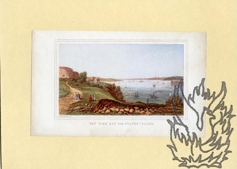
Original coloured Kronheim 'Baxter' engraving, captioned 'New York Bay from Staten Island'.

Author: 
Joseph Martin Kronheim (1810-1896) [George Baxter; New York; Staten Island; engraving; prints; maps; topography]
Publication details: 
[1850s?] 'J. M. Kronheim & Co. London'.
£56.00

Dimensions of print 6.5 x 11 cm. On a piece of paper 9.5 x 16 cm. Neatly laid down on a piece of cream card 15.5 x 21.5 cm. Good clear impression on lightly-aged paper. Charming image, with a couple of fashionable couples looking out over a bay with a steamship and sail boats.

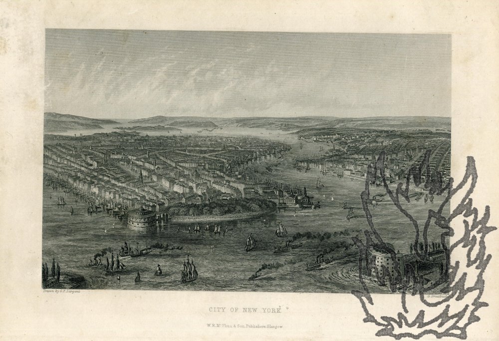
Original steel engraving, drawn by G. F. Sargent and engraved by G. Greatbach, captioned 'City of New York'.

Author: 
William Rae McPhun, Glasgow printseller and bookseller; G. F. Sargent; George Greatbach, London engraver [New York; prints; engravings; maps]
Publication details: 
[1850s?] 'W. R. McPhun & Son. Publishers, Glasgow.'
£56.00

Dimensions of print 12.5 x 19.5 cm. On paper 16 x 24.5 cm. Good clean impression, with six or seven spots of foxing in the margin and a little wear in the bottom left-hand copy. Striking detailed view of the city with sailboats and steamships in the harbour, and the major buildings and layout of the streets clearly portrayed, with the environs in the distance. Scarce: there is little information to be gleaned concerning this print.

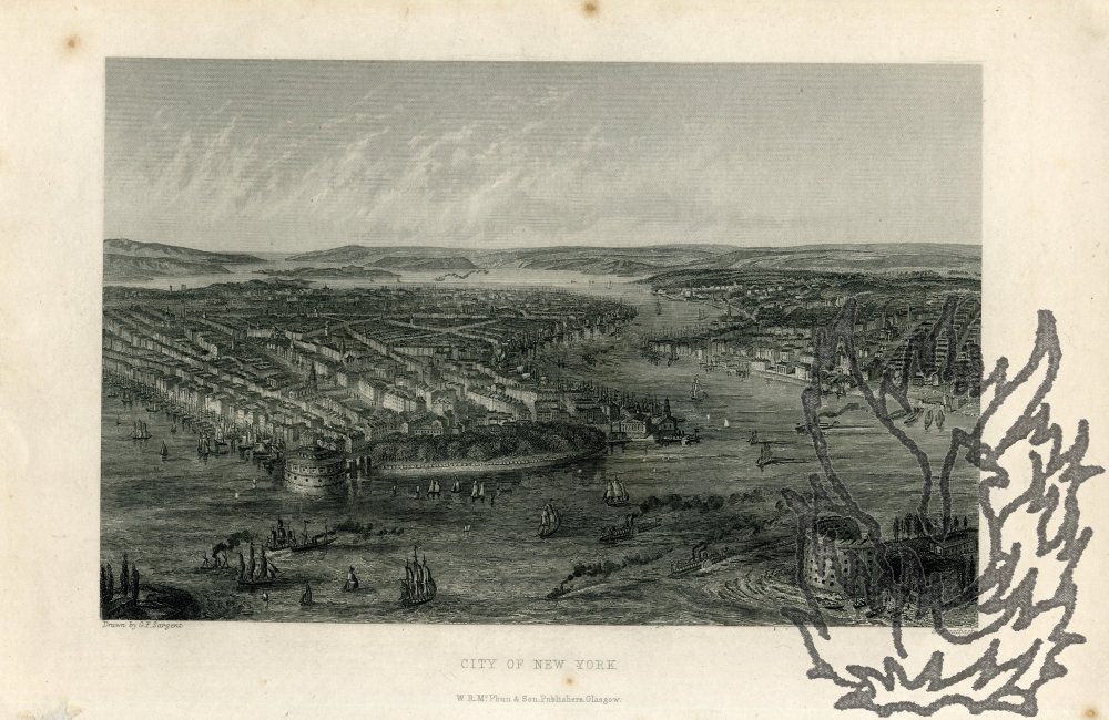
Original steel engraving, drawn by G. F. Sargent and engraved by G. Greatbach, captioned 'City of New York'.

Author: 
William Rae McPhun, Glasgow printseller and bookseller; G. F. Sargent; George Greatbach, London engraver [New York; prints; engravings; maps]
Publication details: 
[1850s] 'W. R. McPhun & Son. Publishers, Glasgow.'
£56.00

Dimensions of print 12.5 x 19.5 cm. On paper 16 x 24.5 cm. Good clean impression, with six or seven spots of foxing in the margin and a little wear in the bottom left-hand copy. Striking detailed view of the city with sailboats and steamships in the harbour, and the major buildings and layout of the streets clearly portrayed, with the environs in the distance. Scarce: there is little information to be gleaned concerning this print.

Three printed plans (numbered 1, 2 and 3) each entitled "Plan of Property in the Isle of Ely belonging to the Master, Fellows and Scholars of Clare College, Cambridge. To be sold by auction by Messrs. Bidwell & Sons. June, 1912."

Author: 
Bidwell & Sons, Surveyors & Auctioneers [Clare College, Cambridge; Isle of Ely, Cambridgeshire]
Publication details: 
All three plans by Bidwell & Sons, Surveyors & Auctioneers, Ely; & 11, Benet Street, Cambridge. 1912.
£120.00

Each plan printed in black on one side of a piece of paper, with areas picked off in blue, green, orange, pink and yellow. Plan No. 1: 72 x 86 cm. Plan No. 2: 88 x 68 cm. Plan No. 3: 76 x 89 cm. The first two very good on lightly aged and creased paper; the third as the first two apart from some wear along a crease resulting in two areas of loss each roughly 2 1/2 x 1 1/2 cm. The various properties (over seventy lots) are numbered, with names of the proprietors of neighbouring estates given.

Map headed 'Position of the Fleet at Spithead on the 28th. June 1902.'

Author: 
Sir William James Lloyd Wharton (1843-1905), hydrographer [Naval Review by King Edward VII at Spithead, 28 June 1902; Royal Navy; Fleet Review]
Publication details: 
London. Published at the Admiralty, 13th. June 1902, under the Superintendence of Rear Admiral Sir W. J. L. Wharton, K.C.B.: F.R.S.: Hydrographer. Sold by J.D. Potter. Agent for the sale of Admiralty Charts, 145 Minories.
£56.00

In light blue, light brown and black on one side of a piece of wove paper roughly 38 x 56 cm. Good: lightly creased and with a little wear at foot. Folded three times. 'Corrections 14th. June' in bottom left-hand corner, and 'Malby & Sons, Lith.' in bottom right-hand corner. Faintly stamped on border at foot 'CHARPENTIER | PORTSMOUTH'. COPAC lists one copy (National Library of Scotland).

2 Autograph Letters Signed by Close (both 'C. F. Close') to Dawkins; and one Typed Letter Signed ('H. R. Douglas') from Douglas to Close.

Author: 
Sir Charles Close [Sir Charles Frederick Arden-Close] (1865-1952), surveyor and geographer; Vice-Admiral Sir Henry Percy Douglas (1876-1939) [Sir Wiliam Boyd Dawkins (1837-1929), geologist]
Publication details: 
Close's letters: 17 and 24 April 1926, both on letterhead of Coytbury, St. Giles's Hill, Winchester; Douglas's letter: 23 April 1926, on letterhead of the Hydrographic Department, Admiralty, Whitehall, London, S.W.1.
£100.00

All three letters good, on lightly aged paper. Close's first letter (12mo, 2 pp): He is pleased to hear 'that Professor O. T. Jones is convalescent and back at work'. Close will write to him to ask if he will take part in the 'Commission' on the 'Terrasses littorales'. Having none 'handy', he is writing to the Admiralty Hydrographer for a 'list of Admiralty Charts'. The Closes have 'settled to take a house in Jersey for the children's holidays', so there is 'little chance of our being at Oxford for the British Association meeting'.

Part of Document signed by "Lapie Directeur de Cabinet".

Author: 
Pierre Lapie.
Publication details: 
Paris, 28 March 1816
£200.00

Topographer and map-maker, author of "Atlas Universel de Geographie Ancienne et Moderne, precede d’un abrege de Geographie Physique et Historique" (author = Colonel au Corps Royal d’Etat-Major, Ancien Directeur du Cabinet Topographique du Roi, Chef de la Section Topographique du Ministere de la Guerre, Chevalier de Saint-Louis, Officier de la Legion-d’Honneur et Commandeur de L’Ordre Grec du Sauveur; et M. Lapie Fils, Captaine au Corps Royal d’Etat-Major, Ancien eleve de l’Ecole Polytechnique). Document, three pages, folio, some defects but clear and complete. In French.

Syndicate content